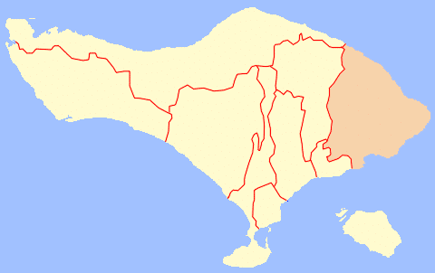
Karangasem Regency (Indonesian: Kabupaten Karangasem) is a Bali regency (kabupaten).
It is located in the east of Bali, has an area of 839.54 km2, and a population of 492,402, according to the 2020 Census.
The town of Amlapura serves as its regency seat. Mount Agung erupted in 1963, destroying Karangasem and killing 1,900 people. Karangasem was a kingdom before the Dutch captured Bali.

Overview
Besakih, Bali’s mother temple, is possibly the most well-known attraction in the Karangasem Regency.
However, there are many more places worth seeing, such as Bukit Jambul Hill, located 12 kilometres north of Klungkung on the road between Klungkung and Besakih. There are restaurants and coffee shops nearby.
Besakih Bali’s mother temple is close too, roughly 60 kilometres from Denpasar or 13 kilometres from Klungkung.
It is made up of 18 temple complexes. Besakih is located on the slopes of Mount Agung. At an elevation of approximately 1,000 metres above sea level.
Batu Madeg in the northwest, Kiduling Kreteg in the south, and Penataran Agung in the centre are the three primary temples dedicated to Shiva, the destroyer.
Districts of Karangasem Regency
| Name | Area in km2 | Population Census 2020 | Number of villages |
|---|---|---|---|
| Rendang | 109.70 | 41,782 | 6 |
| Sidemen | 35.15 | 37,045 | 10 |
| Manggis | 69.83 | 54,608 | 12 |
| Karangasem (district) (a) | 94.23 | 100,036 | 11 |
| Abang | 134.05 | 80,345 | 14 |
| Bebandem | 81.51 | 54,941 | 8 |
| Selat | 80.35 | 44,284 | 8 |
| Kubu | 234.72 | 79,361 | 9 |
| Totals | 839.54 | 492,402 | 76 |
History
The Karangasem Regency existed on the island of Bali by the middle of the seventeenth century. The dynasty claims ancestry from the final Mahapajit Governor of Bali before the Empire’s demise. The state grew in prominence throughout the late seventeenth century, capturing neighbouring Lombok and establishing many principalities on that island. Gusti Gede Ngurah Karangasem [Devata Tohpati] extended dominance over Buleleng in the late nineteenth century. In 1839, the Raja of Mataram, a collateral related, captured the state.
Tourism
Interesting locations include:
- Agung Kanginan Palace: Built in the late nineteenth century by King Anak Agung Gede Jelantik, it has several foreign architectural influences. The royal bedroom with Dutch furnishings and various meeting and ceremonial halls remain in this palace. Royal photographs of the late King and his family and numerous garments are also on show.
- Amed: A beach resort town with Black sand beaches to the North East of Bali.
- Amlapura Town: After Mt. Agung erupted in 1963, the regency capital changed its name from Karagasem to Amplapura, hoping a similar eruption would never occur again.
- Asak and Bungaya: Two villages known for their traditional arts, such as stone carving, woven crafts, and traditional clothing.
- Balina Beach and Yeh Malina: Balina Beach are both beaches near Manggis, with white sand and beautiful water ideal for swimming and fishing. Sunsets are very romantic from this vantage point.
- Bebandem and Putung: Bebandem is a lovely market town, with Putung nearby providing amazing views on a clear day.
- Besakih Temple: From the fourteenth century, Bali’s largest and most respected temple has been built 1000 metres (3333 feet) above sea level on the slopes of sacred Mt Agung. Climbing up one of two staircases across various terraces leads to this temple complex. Each terrace has approximately 30 distinct shrines or pagodas. The interior temple courtyards are not open to the public. Three principal temples were built to worship Siwa, Brahma, and Wisnu: Penataran Agung, Kiduling Kreteg, and Batu Madeg. In addition, a pavilion named Pawedaan, located near the main gate is used by both Buddhist and Shiva priests when doing Weda recitations. Throughout the year, Besakih hosts numerous celebrations and Hindu ceremonies, attracting visitors from around Bali.
- Candi Dasa: A tourist resort named after an ancient temple on a neighbouring hillside. Candi Dasa is a fantastic site to start exploring the eastern half of Bali because of its beautiful beaches and reasonable accommodations. A Gandhi meditation centre is located in the village, directly near the beach, on the edge of a lotus pond. Its offshore islets and coral reefs make it an excellent diving and snorkelling location.
- Manggis: A charming settlement in the foothills of Mt. Agung, with lower temperatures than the coast. Various tiny hotels and villas cater to people seeking a more private setting than Candi Dasa.
- Mt. Agung: Climbing this mountain may take 8 – 10 hours and is only suggested for the physically fit! The view from the peak may be obscured by cloud cover. Trekkers should go out at first light and expect to return before dusk. While the descent is laborious owing to partial tiredness, a considerable number of bottled water, dried fruits, and chocolates are highly recommended!
- Padang Bai: Bali’s largest eastern port, from which ferries and ships travel to Lombok and beyond. Huge luxury cruise ships dock near the Silayukti Sea temple.
- Padangkerta: Events and rituals in this village include trance dances, battles with spiky pandan leaves, and stunning offerings.
- Prasi Beach: Also known as Pantai Pasir Putih (“White Sands Beach”) and Virgin Beach, is located in Prasi hamlet. From April to October, its white sandy beaches are mostly empty, less polluted, and famous for swimming or snorkelling.
- Seraya Village: Maintaining the Gebug Ende custom relating to water scarcity during the dry season on Mencol Hill, Bali’s easternmost hill. The temple at the top of the grassy hill gives a view of the east coast and Gili Selang islet and is regarded as a dawn viewpoint.
- Sibetan and Putung: Well-known for their Salak or snake fruit orchards. Photographers will enjoy the panoramic views of terraced rice paddy fields and the turquoise waters beyond.
- Sidemen: Sideman is well-known for its brocade weaving and the traditional Endek & Songket fabric.
- Taman Ujung Pleasure Palace: Though nothing more than ruins, this water palace depicts a moment of splendour and glamour, with an outstanding view of the Lombok Strait over rice paddy fields. The late King of Karangasem was obsessed with moats, pools, and water gardens. Unfortunately, the 1963 Mt. Agung eruption and the 1979 earthquake severely damaged the palace.
- Tenganan (Balinese Aga village): Descendants of the Original Balinese who lived on this island before the influx of Javanese courtiers & artists of the Majapahit exodus from Java between the 12 & 14th centuries. This well-kept community is located 5 kilometres north of Candi Dasa. They are well-known for weaving the geringsing, a cloth that can take years to weave since the textile patterns are dyed to their final design while the thread is still being woven. The strict Bali Aga does not permit village members to marry outside their community. Children who seek to participate in intrinsic ceremonies are not allowed. Their religious calendar differs significantly from that of the rest of Bali. Between June and July, Tenganan and Dauh Tukad host several spectacular festivities.
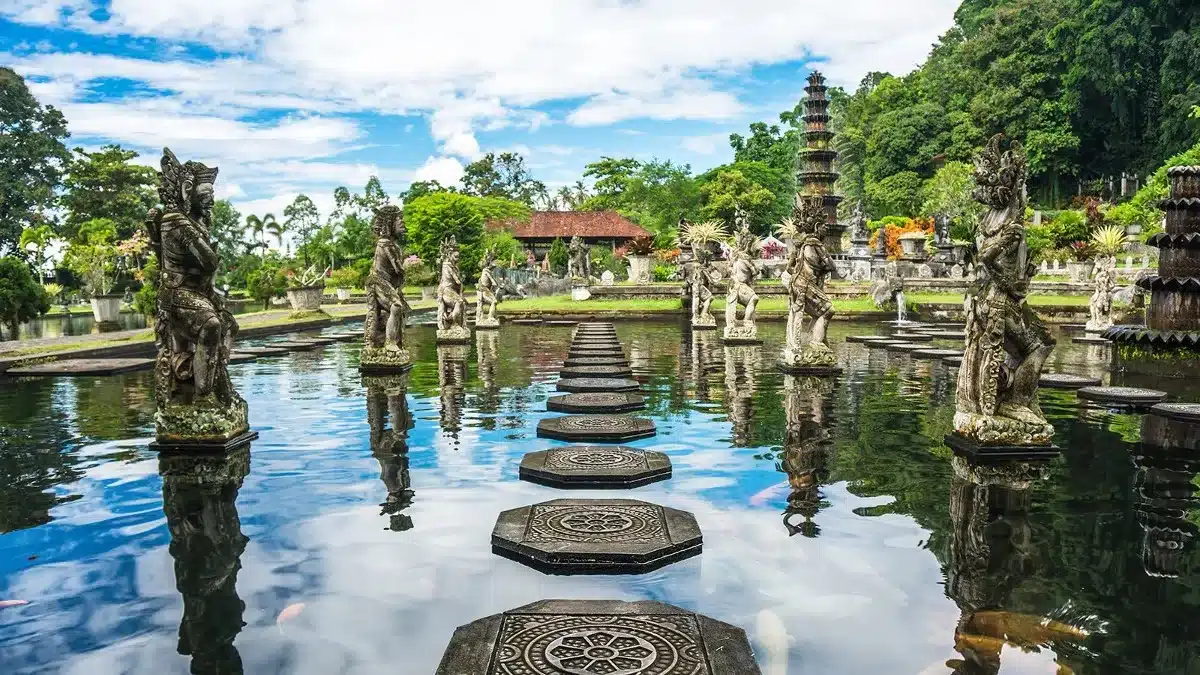
- Tirta Gangga Water Palace: Puri Agung Karangasem is a collection of royal palaces from the Karangasem dynasty Budakeling, home to both Hindus and Muslims. Saren Jawa village has 100 Muslim families and is surrounded by Balinese Hindu communities that practise the Siwa-Buda religious system, a blend of Hinduism and Mahayana Buddhism. Balinese first names are used before Muslim surnames in Saren Jawa, such as Ni Nyoman Maimunah.
- Tulamben Shipwreck: a cargo ship torpedoed in 1942 and sunk on Tulamben’s coast, today offering divers an incredible assortment of marine life in shallow waters (between 2-10 m) and close to the coastline.
- Tulamben: A dive site in Candidasa, is a starting place for exploring Bali’s east coast. East of Candidasa is the village of Bugbug, whose residents celebrate the Perang Dawa (war of the gods) on the full moon of the fourth month, October, every other year.
- Ujung Water Palace: King Anak Agung Agung Anglurah Ketut Karangasem erected the Ujung Water Palace.

